
This is the third in a series of three posts about the gigapan images taken on Heard Island (1: Big Ben, 2: Azorella Peninsula), with more information about the Windy City gigapan.
Windy City is located about 200 meters south of Atlas Cove, in the northwest portion of Heard Island. It comes from a fin of Drygalski Formation rocks, which are a mix of glacial sediments and volcanics, and is mostly surrounded by sand and gravel plains.
Looking closely at the outcrop, there are a number of interesting things to observe. First, there are the striking roughly-horizontal marks, which are particularly evident toward the base of the outcrop. Second, the outcrop is made of massive, fine-grained jointed rocks with few vesicles. Third, there are quite a few fractures within the rock, with discolorations along many of the cracks.
All of these observations combine into a remarkable tale of how Windy City has been formed. The massive, fine-grained, and jointed appearance leads to the conclusion that we are looking at a volcanic outcrop, rather than glacial sediments. Fracturing and discoloration have been brought on by weathering from the very wet, near-freezing environment. Finally, the wind has been a huge factor! Sand, gravel, snow, and graupel (ice pellets) have all been blasted against the side of this outcrop, primarily from the west (at right). On Heard Island, a 9 m/s wind is typical, with maximum recorded gusts exceeding 50 m/s on three days during the 1948-1954 period.[1] The high winds sandblast the outcrop, leading to the horizontal striations.
Here are a few wider-angle shots for context, and with better light than I ended up with for the gigapan.
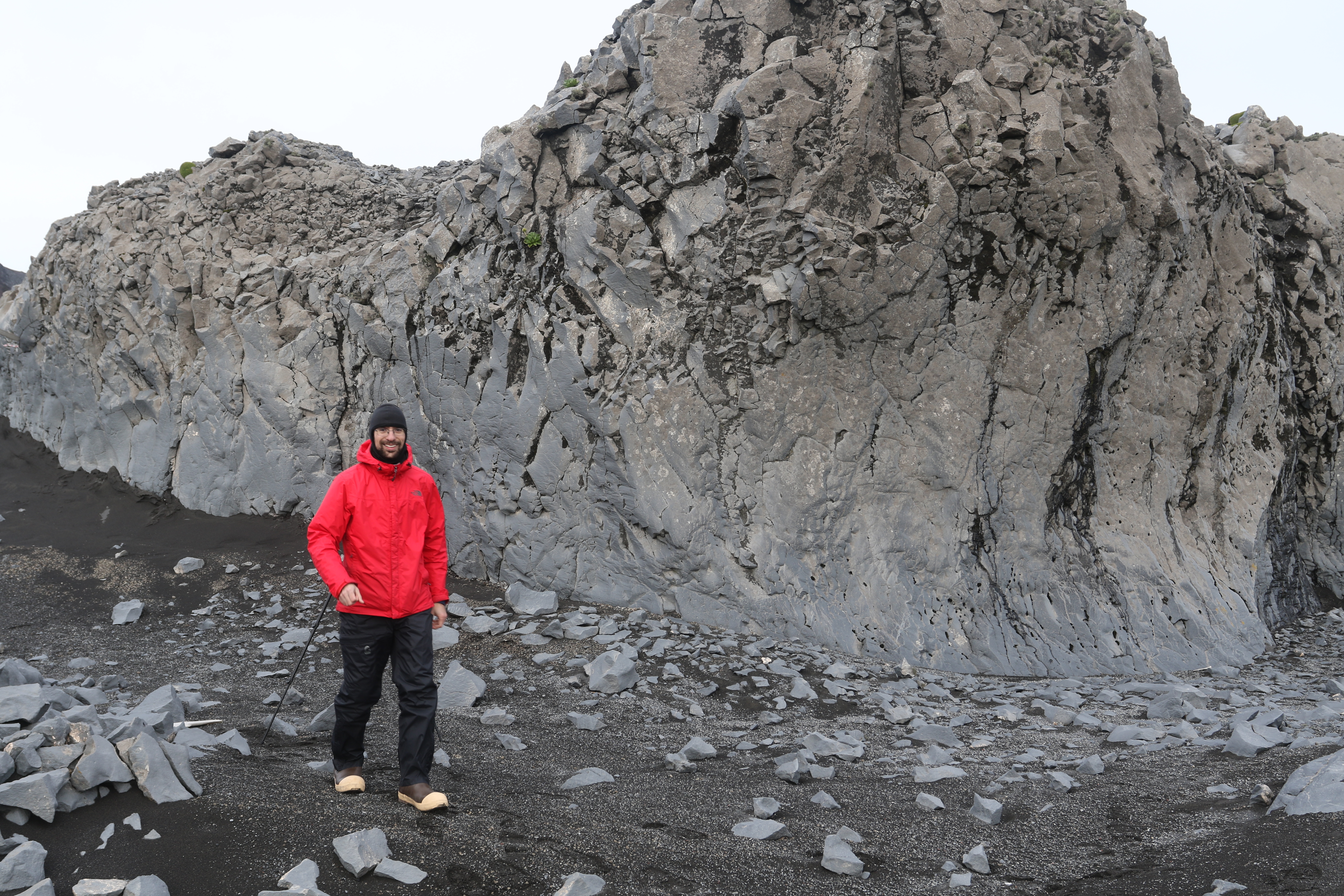

Image credit: Carlos Nascimento
I also managed a close-up shot of one of the pieces of float.

Image credit: Bill Mitchell (CC-BY).
[1] Thost, D., Allison, I. “The climate of Heard Island” in Heard Island: Southern Ocean Sentinel, ed by K. Green and E. Woehler. Surrey Beatty & Sons, Chipping Norton 2005, p. 52-68.
