
In WOGE 597, Stephanie showed us active sand dunes on the eastern shore of Lake Michigan.
Now we leave the glacial plains behind and head for the hills.
Find the location, and leave a comment describing the important geology/hydrology/etc. of the scene. The person to leave the first correct location/comment gets to host the next WOGE.
Complete rules, hints, and a kmz file of previous locations can be found on Felix’s blog.

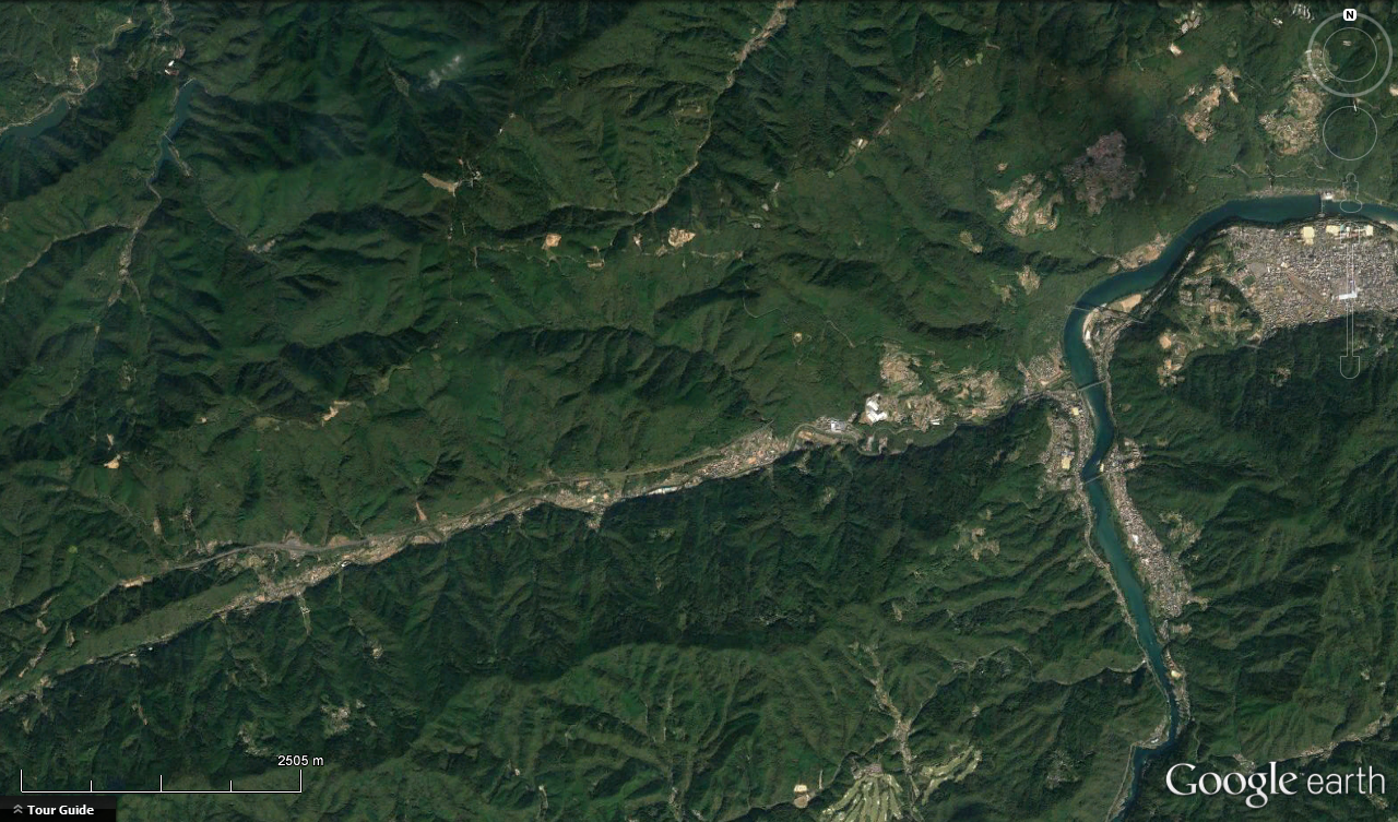
WoGE #598 illustrates the Median Tectonic Line of Japan (https://en.wikipedia.org/wiki/Japan_Median_Tectonic_Line), a major tectonic boundary with right-lateral strike slip motion, near the city of Miyoshi, Tokushima prefecture, on the island of Shikoku. Any further geologic detail I’d be able to give would come from the Wikipedia article.
Location: http://ron.outcrop.org/kml/WoGE598.kmz
LikeLike
More geology here: https://gbank.gsj.jp/geonavi/geonavi.php#13,34.02462,133.77551 if you can figure out how to work that interactive geologic map. The Macrostrat geologic map for that area is considerably less detailed: https://macrostrat.org/burwell/#13/34.0196/133.7728
LikeLike
That’s the spot! 34.0109 N, 133.7393 E
The fault establishes a large, linear feature which stretches across much of southern Japan. In this particular image, the fault creates a very narrow, straight stream channel. I suspect it is also involved in making the bend in the river by Miyoshi quite sharp, and perhaps there’s a bit of a jog in the river as it approaches that bend (it flows NE).
At the left side of the image is the divide between the Tokushima (right) and Ehime (far left) prefectures, as well as the Kagawa prefecture (top). Here the political boundaries reflect the geographic boundaries created by the ridgelines—which are also watershed boundaries.
Over to you, Ron, for WOGE #599!
LikeLike
Everyone waiting for WoGE #599 can relax for a day or two while I get my geoblog functioning again. The new post should be up sometime this weekend.
LikeLike
WoGE #599 is now posted: http://ron.outcrop.org/blog/2017/04/05/where-on-google-earth-599/
LikeLike