
Meteorology is an important consideration for any outing, be it a trip to the grocery store or an extended expedition. You will prepare differently if the temperature is hot enough to melt butter in the shade than you would if it’s cold enough to flash-freeze a pot of boiling water.
There are two different things we will need to keep in mind for these preparations: climate and weather. Although they are related, they are fundamentally different. Climate is long-term, whereas weather is short-term. For instance, the average high temperature* for Minneapolis for January 4th is 24 F. That’s the climatological average; if you’re planning a trip to Minneapolis for January 4, 2016, that’s a ballpark of what to expect. Weather is more variable, of course. In 2015, the high temperature on January 4th was 12 F; in 2014, it was 35 F. That’s weather. Here’s an analogy: take two six-sided dice. On average, when you roll them, their sum will be seven (that’s the climate). However, you shouldn’t be surprised with a roll of three!
Last month at the Five Thirty Eight blog, Nate Silver did a great job analyzing the amount of weather at various cities across the US, and in general exploring this distinction and the limits of its usefulness. Unfortunately, his title is a bit misleading:
“Which City Has The Most Unpredictable Weather?”
His use of unpredictable has nothing to do with the skills or abilities of the local meteorologists.** Instead, it is a reflection of the variability away from the climate average. That is, if you use the climate average as a forecast, how likely is it to be correct? In some areas, such as Phoenix, AZ, the climate average high temperature is a very good predictor. In others, like Minneapolis, the departures from average can be larger and more frequent, as exemplified above.
So, now that we have that discussion out of the way, and deferring things like uncertainty to another post, what do we know about Heard Island?
Expect cool temperatures, wet weather, and plenty of wind. The vast icy waters surrounding the island keep conditions from changing much. Temperatures remain near freezing year-round, with monthly average temperatures in summer still only 5.2 C (~41 F). The ocean provides plenty of moisture too; a research expedition from 1948-1954 recorded precipitation on 75% of days at Atlas Cove, one of the more accessible parts of the island.
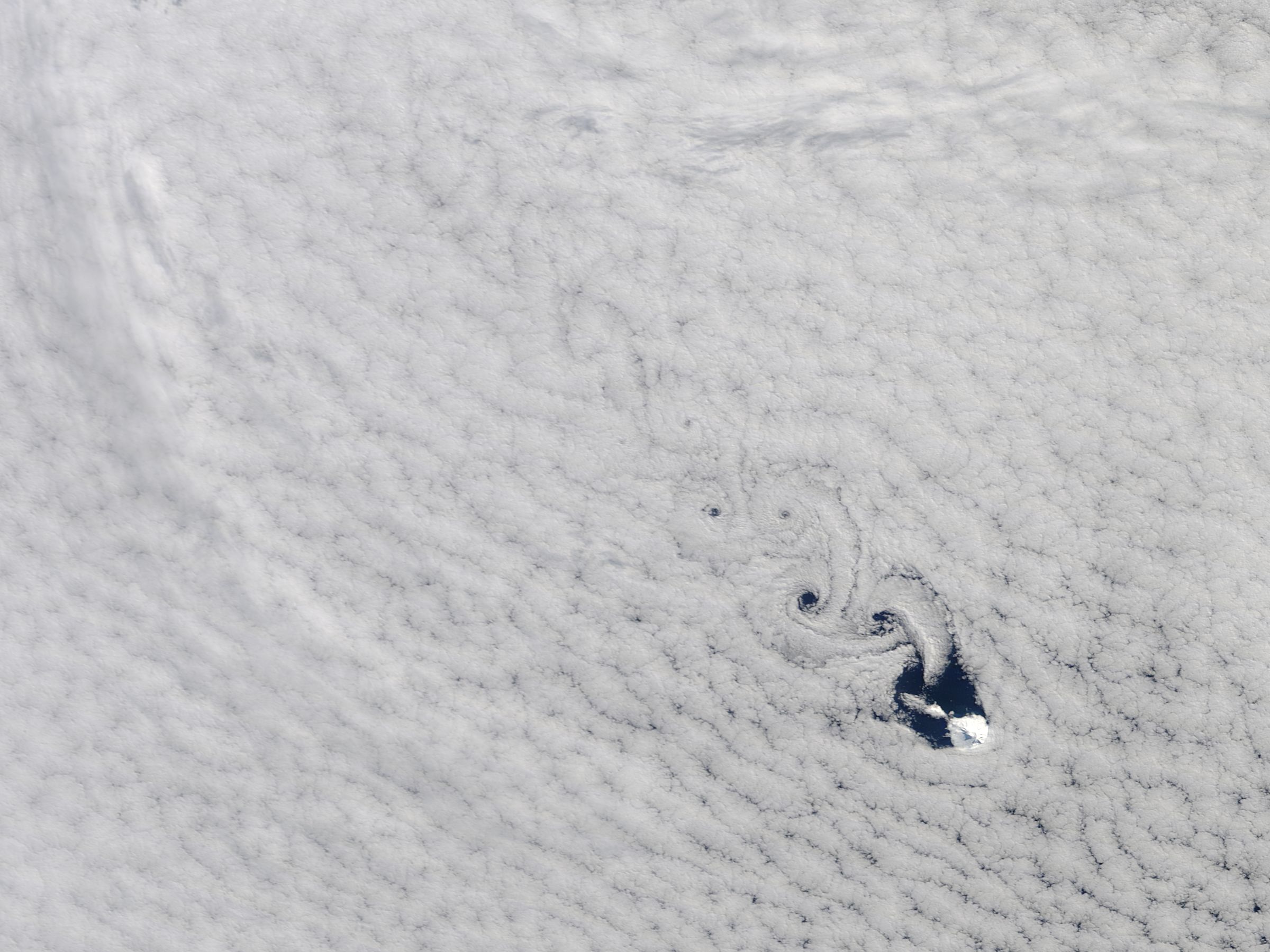
The volcano can make its own weather by disrupting the west-to-east winds. Windward locations tend to see more fog and rain (like the coastal parts of San Francisco), while leeward areas see more sun and warmer temperatures (like Berkeley or Palo Alto). Lenticular clouds, formed when the humid air is pushed up around the mountain, are also found at Heard Island. Other conditions can cause cloud vortices when the smooth flow of wind is disrupted while passing the island, as seen in the picture at the top of this post.
In the southern hemisphere, there is much less land to disrupt the smooth flow of air than there is in the northern hemisphere. Consequently, the winds tend to be stronger more consistent. At Atlas Cove, the average wind speeds are around 26-33.5 km/h (16-21 mph), with gusts recorded up to ~180 km/h (110 mph). That means we can expect damage similar to that found from a borderline EF1/EF2 tornado.***
In short, the climate of Heard Island is near-freezing, wet, and strongly influenced and moderated by the water around it. Be prepared for cold, snow, rain, and wind. There will be some sunshine in there too, but it won’t be the norm.
* The National Weather Service computes this over the 30-year period of 1981-2010.
** Variable would have been a more appropriate word, because devious has deviated from the sense which would be useful here.
*** Tornado categories use the Enhanced Fujita scale (0-5, 5 is strongest), and are estimates of wind speed based on damage. Obviously we’d rather use a direct measurement and have our camp sturdy enough to not have damage to use for estimating wind speed. More on the inner workings of the (enhanced) Fujita scale can be found at the NOAA Storm Prediction Center.

Love a good image of von Karmen vortices. Also good bit about the 538 blog piece.
LikeLike